Cyclone Mocha became very powerful, its effect will be seen in many states

know the weather forecast,

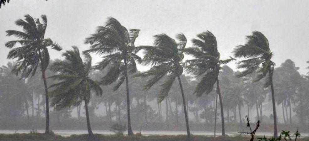
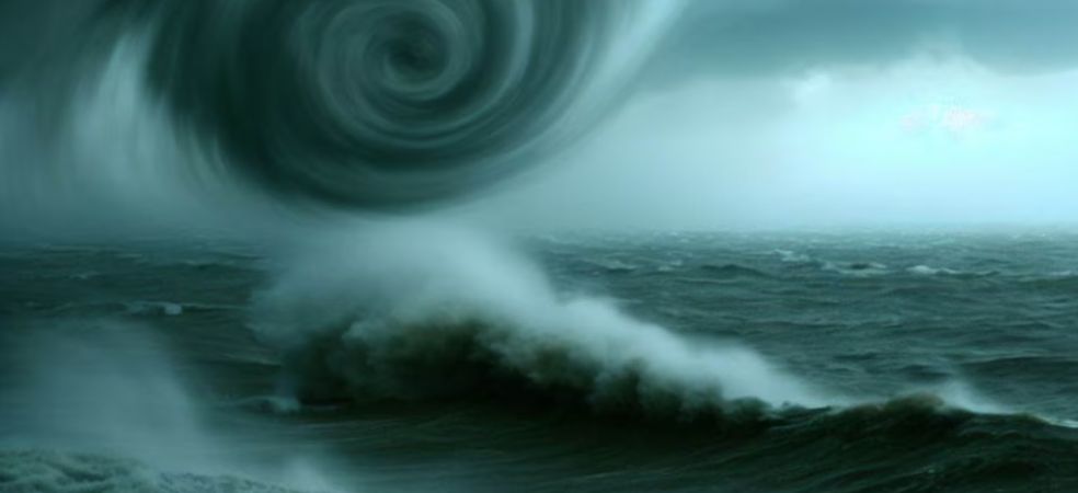
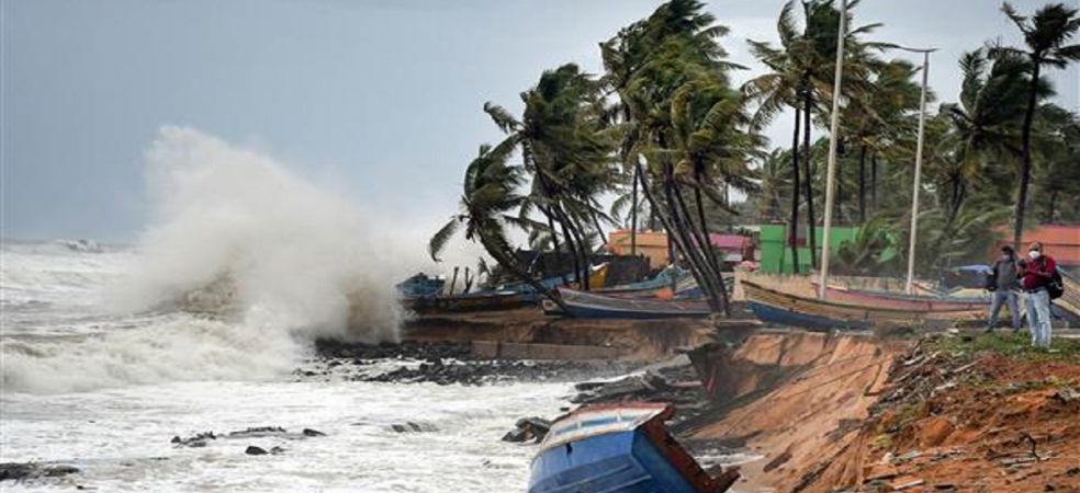
Cyclone Mocha has now become extremely powerful. The sea surface temperature in the Bay of Bengal is 30 degrees which can make it more powerful. With this speed, it is moving towards the coast of Bangladesh and Myanmar. While hitting the coast, the wind speed could be 150 to 160 kmph and 170 kmph at some places. On May 14 and 15, there will be strong winds with torrential rains over the North Eastern states of India. High waves with strong winds will rise in the sea along the coast of West Bengal and Orissa. Hot and dry northwesterly winds will continue to cause severe heatwave conditions across India.

Source: Skymet Weather

Do visit the Gramophone app daily for weather forecast information. If you liked today’s information, then do like and share.

Share

A severe storm will hit the coast on May 14, see where it will affect

know the weather forecast,

The very severe cyclonic storm that formed in the Bay of Bengal is now moving in the north direction. It is likely to move slowly in the northeast direction and land between Myanmar and Bangladesh on May 14. Torrential rains with strong winds and high sea waves are possible. Its effect will also be seen in Myanmar, Bangladesh, West Bengal and Orissa. West Bengal and Orissa will see only cloudy sky with slight increase in winds and high waves in the sea. Now the temperature of most of the states of the country has reached above normal. The outbreak of severe heat waves will also be seen over South India including entire North Central and East India.

Source: Skymet Weather

Do visit the Gramophone app daily for weather forecast information. If you liked today’s information, then do like and share.

Share

Many states will be affected by the storm, see how the weather will be

know the weather forecast,

This year’s first cyclone Mocha has formed in the Bay of Bengal. It is likely to strengthen further after hitting the sea surface and it may further strengthen into a severe cyclonic storm. In the coastal districts of Orissa and West Bengal, there may be high waves in the sea with strong winds. But the direction of this storm is towards the northern parts of Bangladesh and Myanmar. Northwest dry winds will now continue to blow over most parts of India, due to which the temperature will rise across the country and heat waves will start appearing in many states. The hot summer season has almost started.

Source: Skymet Weather

Do visit the Gramophone app daily for weather forecast information. If you liked today’s information, then do like and share.

Share

Where will it rain for the next 3 days, see the weather forecast for your area

know the weather forecast

The deep low-pressure area in the Bay of Bengal will soon become a depression and thereafter a storm. This storm is likely to become more powerful and move towards north Myanmar or Bangladesh. Due to the effect of hot and dry winds blowing from the Thar Desert including Sindh and Balochistan, the weather of most of the states of the country will become very hot. The outbreak of scorching heat will disturb. Light rain may occur over the northeastern states.

Source: Skymet Weather

Do visit the Gramophone app daily for weather forecast information. If you liked today’s information, then do like and share.

Share

Bay of Bengal storm will increase, see weather forecast

know the weather forecast,

A depression has formed in the Bay of Bengal, which will gradually strengthen into a storm. Under its influence, northwesterly dry and hot winds will affect northwest central and eastern India across Sindh, Balochistan and the Thar Desert. Temperatures will rise in the south as well. In many states of the country, the figure of 40 degrees has been crossed. Now the rain activities will be almost over from North West Central and East India.

Source: Skymet Weather

Do visit the Gramophone app daily for weather forecast information. If you liked today’s information, then do like and share.

Share

Heavy rain will continue in some areas, see weather forecast

know the weather forecast,

Snowfall with heavy rain is very likely over the mountains during the next 2 days. From Punjab, Haryana, and Delhi to Rajasthan, Gujarat, Madhya Pradesh and East India will remain dry and warm, heavy rains will continue over South India.

Source: Skymet Weather

Do visit the Gramophone app daily for weather forecast information. If you liked today’s information, then do like and share.

Share

Chances of rain with dusty storms, see the weather forecast

know the weather forecast,

During the next 24 hours, dust storms may occur in some parts of Delhi including Punjab, Haryana and Rajasthan and there may be light drizzle at one or two places. Snowfall will continue with heavy rains in the mountains as well. Due to torrential rains in South India, the temperature will be below normal. The storm will form in the Bay of Bengal and move further in the north direction. Its stance may be towards Myanmar or Bangladesh. Clouds of danger will continue to hover over West Bengal as well.

Source: Skymet Weather

Do visit the Gramophone app daily for weather forecast information. If you liked today’s information, then do like and share.

Share

Rain will continue for the next 3 days, see the weather forecast

know the weather forecast,

Rain activities will almost end in many states of the country. Rain and snowfall may continue in the mountains for the next 3 days. Light rain with thundershowers is very likely at one or two places over parts of Punjab, Haryana, Delhi and North Rajasthan. Heavy rains will continue in many states of South India. Light rain may occur over Maharashtra and light to moderate rain over northeastern states. On May 7, low pressure will form in the Bay of Bengal, which may gradually intensify into a cyclonic storm Mocha by May 10. Right now its direction is towards Bangladesh or Myanmar but its impact on Odisha and West Bengal cannot be denied.

Source: Skymet Weather

Do visit the Gramophone app daily for weather forecast information. If you liked today’s information, then do like and share.

Share

Cyclone Mocha will cause heavy rain in many states

know the weather forecast,

The first sea storm of this season is about to form in the Bay of Bengal. Many states are at risk. The rain activities will now start reducing from Northwest and Central India. But heavy rains may continue over South India including East, and Northeast India. From May 7, rain activities will start reducing in almost all parts of the country and the temperature will start rising. The rains may continue for several days in the south.

Source: Skymet Weather

Do visit the Gramophone app daily for weather forecast information. If you liked today’s information, then do like and share.

Share

Storm in Bay of Bengal will affect many states, see weather forecast

know the weather forecast,

A cyclonic circulation would form over southeast parts of the Bay of Bengal around May 6, under whose influence a low-pressure area could develop. This low pressure can deepen into a deep depression. There is also a chance of it becoming a cyclonic storm ‘Moka’. Right now it may move towards southern parts of West Bengal, Bangladesh or Myanmar. After the next 2 days, the weather in more than half of India will become dry and the temperature will start rising. Rain activities may continue over South India.

Source: Skymet Weather

Do visit the gramophone app daily for weather forecast information. If you liked today’s information, then do like and share.

Share